Many of you are aware of the ancient nature of floodplain meadows. A number of people have explored archive material to show that some existing sites have been managed in the same way for 1000 years or more with evidence in some cases of a 2000 year history.
Floodplain meadows were one of the most productive and valuable land uses in the Domesday Book, and the hay was shared in a parish as a result. This communal system led to the term Lammas Meadows. After the hay was cut (typically in multiple narrow strips or blocks), everyone was allowed to graze the aftermath, but this couldn’t happen till after Lammas Day (12th August). The existence of the Lammas system probably helped to preserve some sites for longer than individually owned meadows, and the physical remnants of this can still be observed in some sites (e.g. the presence of dole stones marking different hay lots).
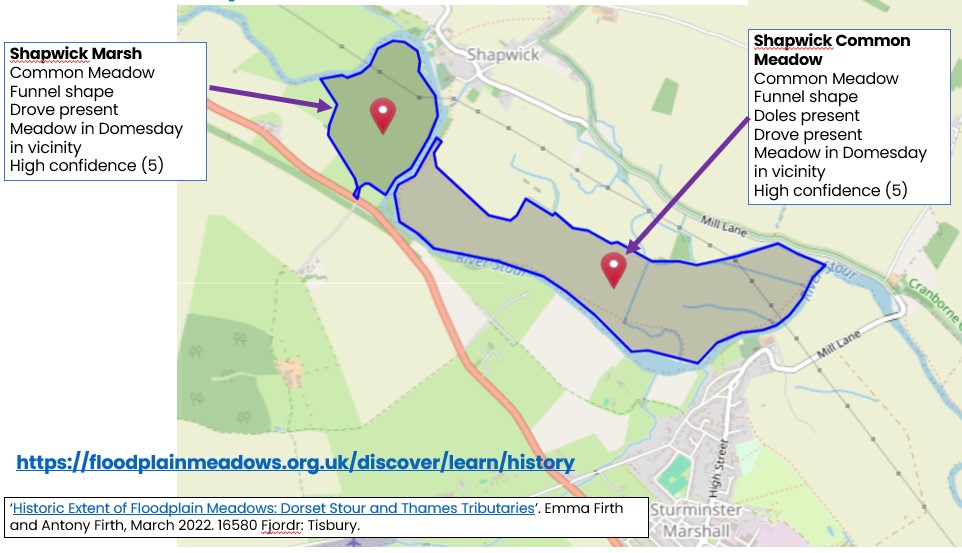
We have reported before[1] about a method developed to record floodplain meadows from early maps that have been digitised (e.g. early OS maps and tithe maps). This method, developed by Fjordr working with us, has now been used in seven catchments and the similarities are striking.
Across all the catchments, from north to south and into Wales, floodplain meadows were prevalent in the early 1800’s. From the seven catchments recorded, 11,660 ha of floodplain meadow have been identified as meadows managed in common. Of course, this is a snapshot and also only picks up those meadows that show the shared management attributes.
However, Fjordr have also looked at Domesday records and during the work on the Swale and Ure catchments in Yorkshire, they compared their findings to much more in depth and longer history archive research undertaken by Martin Hammond, and the findings were consistent using both methods. The Domesday records cannot be interpreted to specific sites, but it is consistent that there were typically meadows recorded in the parishes that were also found to contain meadows in the 1800’s.
One of the striking findings has been extensive records of floodplain meadows in catchments where there is no record of the plant community associated with that management now. For example, the River Stour, Dorset, and the Upper Wye in Wales. Both have plenty of evidence for floodplain meadows on the old maps, but no evidence for the plant communities created by such management now.
We can use this method with some confidence, having tested it against other methods and across a range of catchments. We can use it to help think about where we might want to prioritise restoration activity, as part of landscape-scale projects to identify potential sites and as a way to talk to landowners about a shared and rich history. And we can use it to remind ourselves that the landscape we have or had until about 50 years ago, was created by a long and deep interaction between people and landscape in the human quest for survival.
All our findings (apart from the Wye work) are on our historical map here where you can explore the catchments that have been assessed and find our the level of data and cofidence for each site recorded.

Please do consider using this as a tool to help with restoration planning. The method has been described in detail here.
If you are planning landscape wide floodplain restoration and would like our input, please do get in touch.